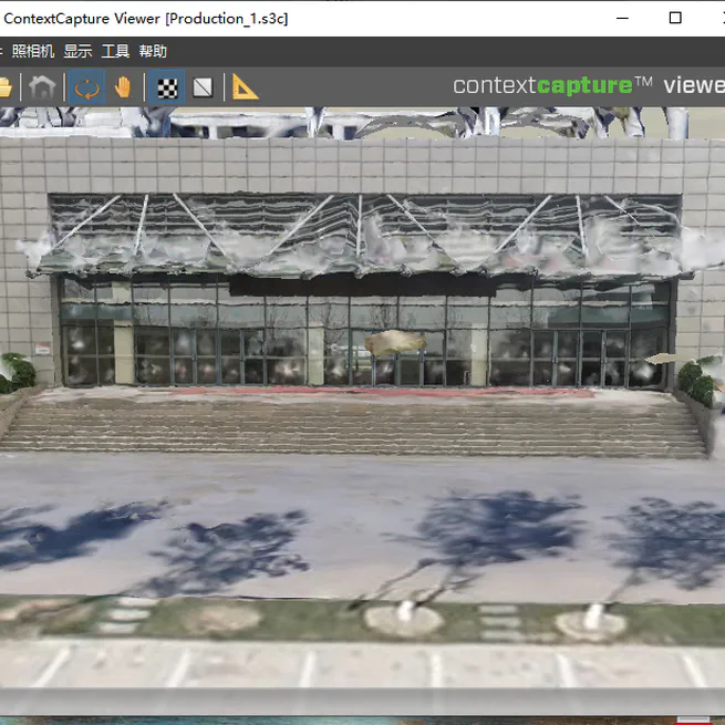
High-Fidelity 3D Model Reconstruction using Air-Ground Fusion
Standard 3D models created from UAV (drone) imagery are excellent for capturing large areas quickly, but they often suffer from significant limitations at ground level. Textures on building facades can be blurry, and complex structures like covered walkways or overhangs are often distorted or incomplete. This project aimed to solve this common industry problem by developing a method to enhance model accuracy and detail.
May 17, 2021

Spatial Analysis and Cartography: Creating China's Annual Precipitation Distribution Map
The goal of this project was to create a comprehensive and cartographically refined thematic map illustrating the annual precipitation patterns across China. This project showcases a complete GIS workflow, from raw data processing and advanced spatial analysis to final map production and design.
Sep 12, 2020
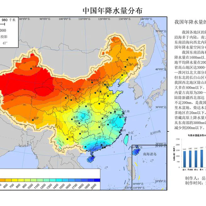