This project aimed to investigate the relationship between socioeconomic deprivation and educational attainment across London. The central question was - Is there a measurable link between living in a deprived area and having lower educational qualifications, and what does this pattern look like geographically?
May 19, 2024
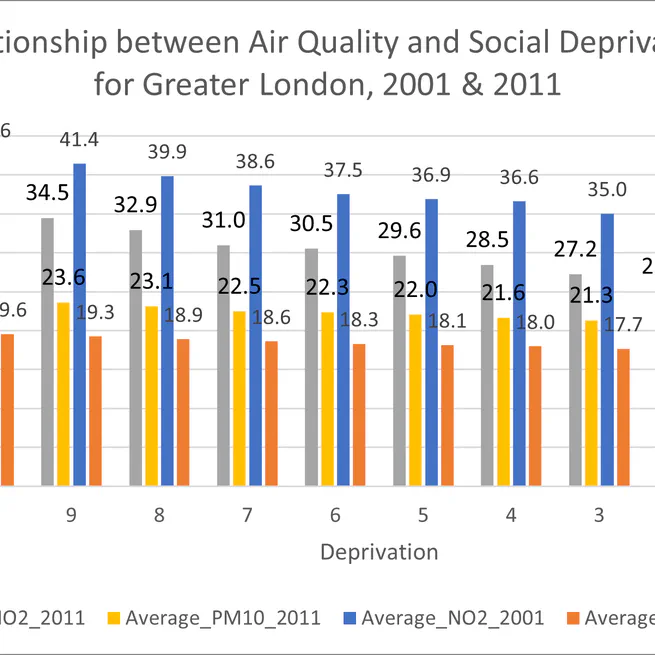
Air pollution is a major public health risk, but is its burden shared equally across society? This project investigates the concept of environmental justice by assessing how the social distribution of air quality changed in London over a decade. The central question was - Did environmental inequality improve or worsen between 2001 and 2011?
Apr 18, 2024
To help the Leeds-based charity Learning Partnerships identify neighbourhoods with the highest concentration of young, disadvantaged adults. The aim was to create a data-driven map to guide their outreach and support services.
Feb 27, 2024
Performed a site suitability analysis in ArcGIS Pro to identify optimal locations for a new solar park in Scotland. I used Multi-Criteria Evaluation (MCE) and raster analysis to combine factors like elevation, aspect, soil type, and proximity to infrastructure. The project culminated in a favorability map that provides a data-driven recommendation for stakeholders.
Jan 17, 2024