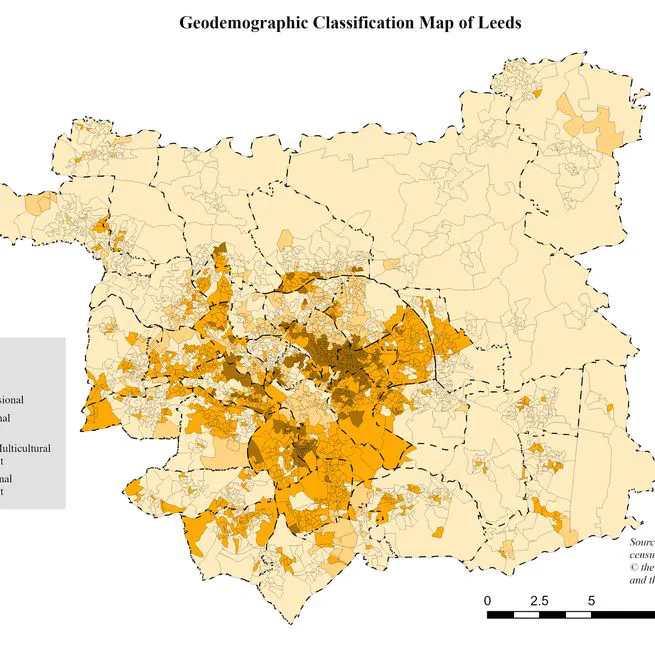
Geodemographic Classification for Social Impact: Targeting Youth Support in Leeds
To help the Leeds-based charity Learning Partnerships identify neighbourhoods with the highest concentration of young, disadvantaged adults. The aim was to create a data-driven map to guide their outreach and support services.
Feb 27, 2024
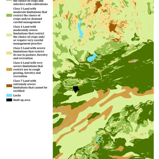
Solar Park Site Suitability Analysis: A Multi-Criteria Evaluation in Scotland
Performed a site suitability analysis in ArcGIS Pro to identify optimal locations for a new solar park in Scotland. I used Multi-Criteria Evaluation (MCE) and raster analysis to combine factors like elevation, aspect, soil type, and proximity to infrastructure. The project culminated in a favorability map that provides a data-driven recommendation for stakeholders.
Jan 17, 2024