
Co-founded an award-winning non-profit to bridge the information gap in geospatial education. Spearheaded the creation of an open-access database covering 480+ GIS programmes globally and orchestrated a content strategy that grew a community of 180,000+ followers with 500k+ views. A synthesis of data management, educational equity, and digital growth.
Nov 23, 2025
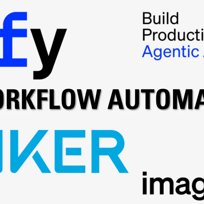
Designed and deployed a bespoke AI agent workflow on the Dify platform for Anker (a top global consumer electronics brand). The solution automated complex market research and SEO copywriting tasks, resulting in 4× faster reporting and a 20% increase in campaign accuracy.
May 27, 2025
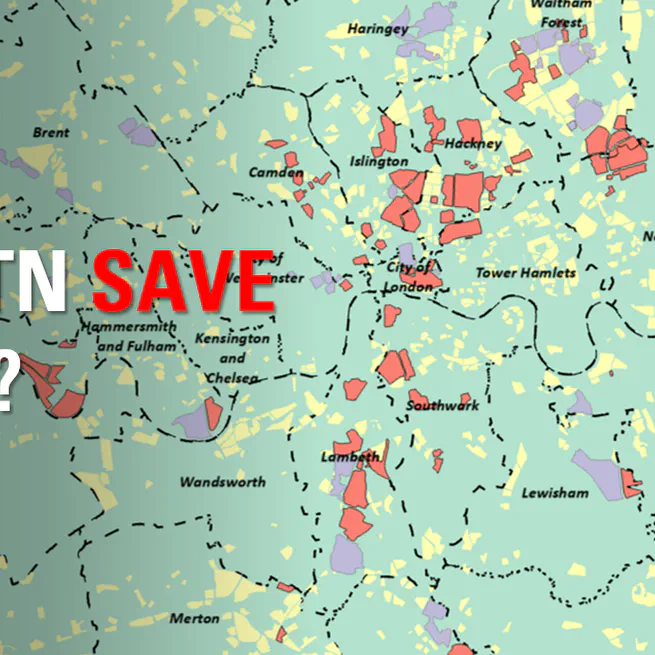
How Effective are Low Traffic Neighbourhoods in Reducing Traffic Accidents? A City-Wide Difference-in-Differences Study in London.
Aug 16, 2024
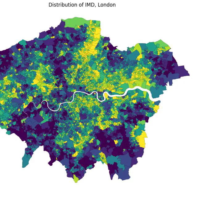
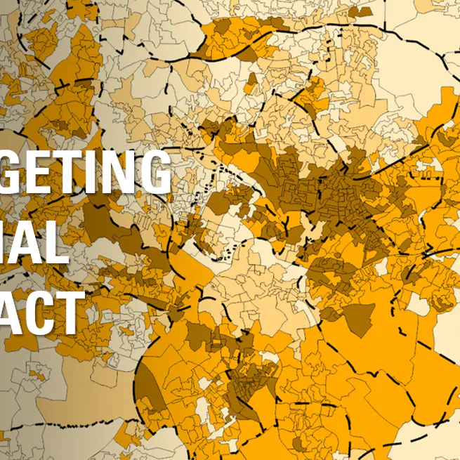
This project aimed to investigate the relationship between socioeconomic deprivation and educational attainment across London. The central question was - Is there a measurable link between living in a deprived area and having lower educational qualifications, and what does this pattern look like geographically?
May 19, 2024
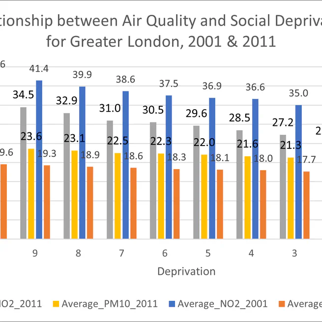
Air pollution is a major public health risk, but is its burden shared equally across society? This project investigates the concept of environmental justice by assessing how the social distribution of air quality changed in London over a decade. The central question was - Did environmental inequality improve or worsen between 2001 and 2011?
Apr 18, 2024
To help the Leeds-based charity Learning Partnerships identify neighbourhoods with the highest concentration of young, disadvantaged adults. The aim was to create a data-driven map to guide their outreach and support services.
Feb 27, 2024
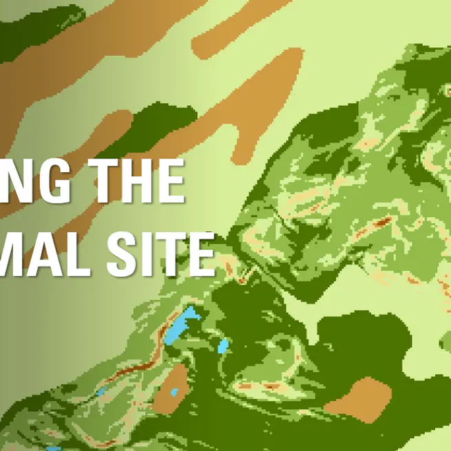
Performed a site suitability analysis in ArcGIS Pro to identify optimal locations for a new solar park in Scotland. I used Multi-Criteria Evaluation (MCE) and raster analysis to combine factors like elevation, aspect, soil type, and proximity to infrastructure. The project culminated in a favorability map that provides a data-driven recommendation for stakeholders.
Jan 17, 2024
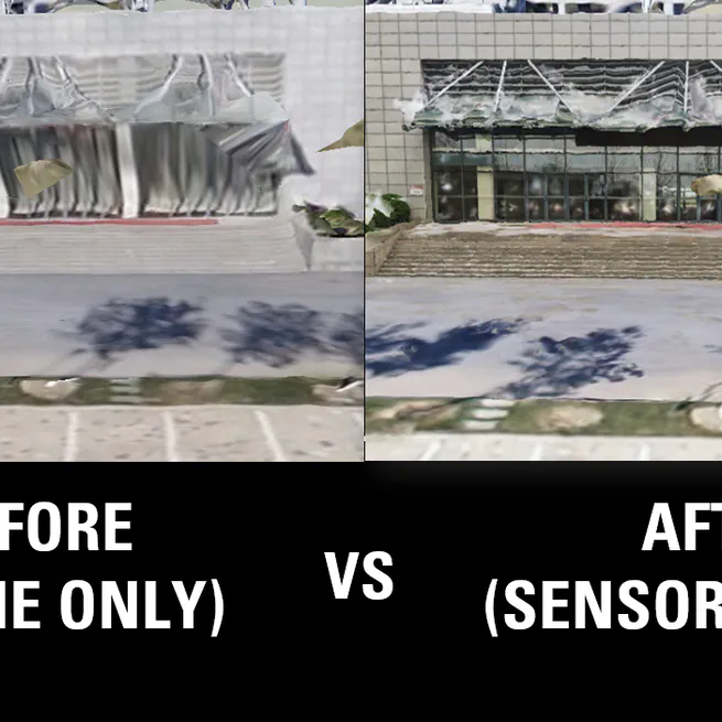
Standard 3D models created from UAV (drone) imagery are excellent for capturing large areas quickly, but they often suffer from significant limitations at ground level. Textures on building facades can be blurry, and complex structures like covered walkways or overhangs are often distorted or incomplete. This project aimed to solve this common industry problem by developing a method to enhance model accuracy and detail.
May 17, 2021
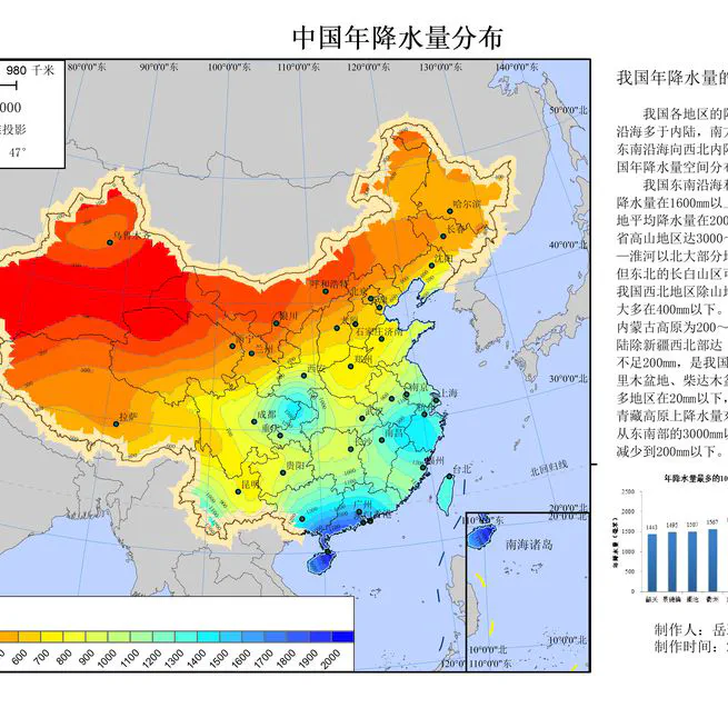
The goal of this project was to create a comprehensive and cartographically refined thematic map illustrating the annual precipitation patterns across China. This project showcases a complete GIS workflow, from raw data processing and advanced spatial analysis to final map production and design.
Sep 12, 2020