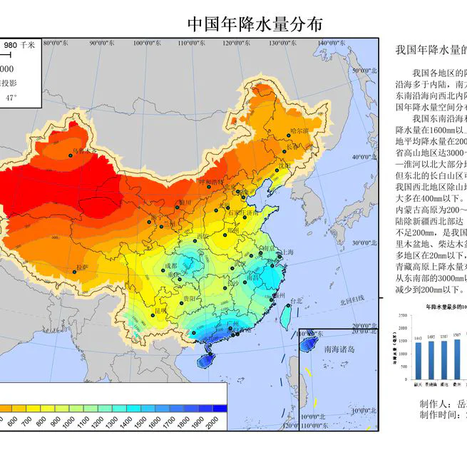
The goal of this project was to create a comprehensive and cartographically refined thematic map illustrating the annual precipitation patterns across China. This project showcases a complete GIS workflow, from raw data processing and advanced spatial analysis to final map production and design.
Sep 12, 2020
California Housing Valuation: A Geo-XAI Approach Integrating GIS Feature Engineering with Explainable AI 1. Project Overview This project aims to build a robust valuation model for California real estate by fusing Geospatial Analysis with Machine Learning. Unlike traditional models that treat location merely as coordinates, this approach engineers spatial features (specifically proximity to the coastline) to capture the non-linear economic value of “location”.
Jan 1, 0001